Networking Fridays
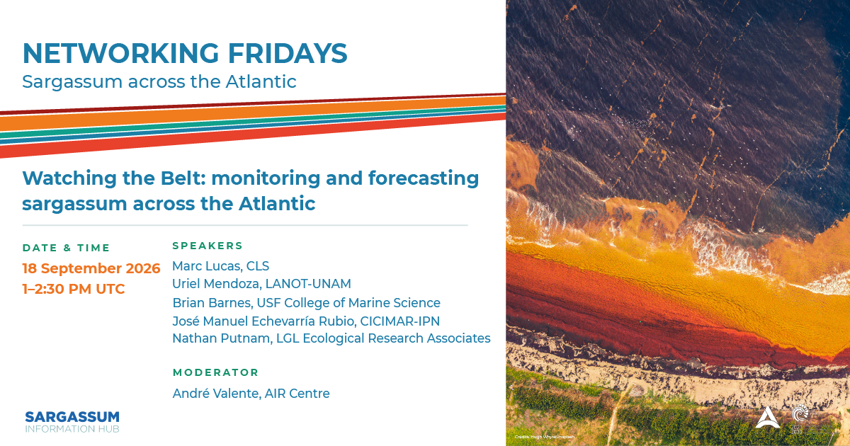
Watching the Belt: monitoring and forecasting sargassum across the Atlantic
Date
September 18, 2026, 1:00 PM UTC
AIR Centre Networking Fridays
More information about the Webinar series hereWatch the Recording
Watch on YouTube ↗Networking Fridays on Sargassum Across the Atlantic is a five-episode series recurring cross-Atlantic dialogue connecting researchers, environmental managers, health professionals, policymakers, entrepreneurs, and community representatives working on the sargassum crisis. Each session pairs regional practitioners dealing with sargassum on the ground with specialists whose expertise can directly inform local responses, building not just knowledge transfer, but lasting cross-Atlantic partnerships.
Since 2011, the Great Atlantic Sargassum Belt (GASB) has sent billions of tonnes of pelagic algae onto Atlantic shores each year. This opening session establishes the scientific foundation of the series: how satellite remote sensing, ocean circulation models, and drone-based protocols are used to detect, track, and forecast sargassum blooms at basin scale – and how that information reaches the coastal managers who need it most. The session also explores why blooms have intensified since 2011 and what scenarios the next decade may bring.
Programme · UTC
1:00-1:05 - Welcome remarks and introduction by André Valente (AIR Centre)
1:05-2:05 - Speakers presentations:
Providing Sargassum Observation for Copernicus Marine; Marc Lucas (CLS, France)
Satellite Detection, Seasonal Forecasting and Alert Products for Coastal Managers; Uriel Mendoza (LANOT-UNAM, Mexico)
Tracking Sargassum from space: multi-sensor observations, trajectory forecasts, and data distribution; Brian Barnes (USF, USA)
Predicting Pelagic Sargassum Trajectories: Integrating Lagrangian Drift Models with Corrections; José Manuel Echevarría (CICIMAR-IPN, Mexico)
Sargassum Dynamics: Forecasting, Modelling Distribution and Drift; Nathan Putman (LGL Ecological Research Associates, USA)
2:05-2:30 - Q&A, moderated by André Valente (AIR Centre)
Moderators
André Valente
AIR Centre
André Valente leads the Space Systems and Applications programme at the AIR Centre and is involved in various regional and EU-funded projects, working at the intersection of Earth observation, ocean science, and applied research. He holds a Degree in Meteorology and Physical Oceanography from the University of Lisbon, a postgraduation in Ocean Remote Sensing from the University of Southampton, and a PhD in Environmental Sciences from the University of Azores, and previously worked as a researcher at the Center of Oceanography and MARE Centre of the University of Lisbon. He specializes in the integration of Earth Observation satellite data, models and in-situ observations, and development of remote sensing methods, for different types of applications in the fields of ocean colour, physical oceanography, ocean climate variability, physical-biological interactions and plastic pollution.
Speakers
Brian Barnes
USF College of Marine Science
Dr. Barnes is a Research Associate Professor in the Optical Oceanography Lab at the University of South Florida College of Marine Science. His research focuses on assessment and monitoring of coastal systems from satellite remote sensing platforms. Specific research focuses include improving coastal water quality derivations, detection of floating matters (e.g., the macroalgae Sargassum), optically shallow waters, and calibration of satellite sensors and algorithms. A key component of his work is distribution of satellite data to inform resource managers and the broader public. He is currently an Associate Editor for Estuaries and Coasts, as well as a member of the NASA PACE Science and Applications Team and several international working groups covering these research topics.
José Manuel Echevarría Rubio
CICIMAR, Instituto Politécnico Nacional
Dr. José Manuel Echevarría Rubio is a marine data scientist specializing in satellite remote sensing, and ocean transport modeling. He holds a PhD in Marine Sciences from CICIMAR-IPN (Mexico), and was recently a Nippon Foundation-POGO Centre of Excellence fellow in Observational Oceanography in Canada. His research focuses on integrating ML frameworks with Lagrangian particle-tracking models (OpenDrift and OceanParcels) and multi-sensor satellite imagery (Landsat-8/9 OLI and Sentinel-2 MSI) to improve trajectory forecasting, mesoscale velocity corrections, and coastal early-warning systems for pelagic Sargassum across the Equatorial Atlantic and Caribbean Sea.
Marc Lucas
CLS
Dr. Marc Lucas is a senior oceanographer at CLS. He holds a BSc in ocean Science from the University of Plymouth UK, an MSc in Oceanography and a PhD in Physical Oceanography both from the University of Southampton, UK. After 3 post Docs in France and Germany mostly focused on numerical modelling, he joined the CLS team dedicated to providing metocean services to the Offshore Energy industry. He then joined the CLS Environmental Monitoring Division with a focus on the use and interpretation of combined Satellite, in situ and model data. Since 2018, he has been working on Sargassum detection by satellite and has helped develop the CLS SAMTool monitoring solution. He now leads the CLS Sargassum Task force, coordinating the development of state of the art customer focused solutions.
Nathan Putnam
LGL Ecological Research Associates
Dr. Putman works for the private research company, LGL Ecological Research Associates in Bryan, Texas USA. He conducts empirical studies on organismal traits relevant to understanding the mechanisms of movement to parameterize simulations of individual movements within realistic environmental models. By explicitly considering the interaction between the organism and environment (mediated by physiology, sensory processing , and behavior), this approach is more sensitive than traditional modelling/mapping techniques to predict shifts in distribution and abundance in response to changing environmental conditions. His work includes a diverse range of topics: monitoring fisheries effort, studying geomagnetic navigation in marine migrants, using ocean circulation models to explore marine connectivity, and conducting studies on pelagic Sargassum to improve forecasts of coastal inundations. Since 2007 he has contributed more than 90 peer-reviewed publications to the scientific literature related to marine organism movement, with ~15 focused on Sargassum.
Uriel Mendoza
LANOT-UNAM
Uriel de Jesús Mendoza Castillo holds a degree in Geomatics from UNAM and a Master’s degree in Geospatial Information Science from CentroGeo. His work focuses on satellite image processing, remote sensing, deep learning applied to Earth observation, spatial data infrastructures, and the development of geospatial web platforms for environmental monitoring, with a particular emphasis on sargassum detection and forest fire severity. Since 2018, he has been part of the LANOT team, contributing to the automation of the sargassum detection algorithm based on Sentinel-2 imagery and the development of its operational monitoring platform. He is a co-author of peer-reviewed publications on satellite monitoring of sargassum in the Mexican Caribbean and a member of the 2025 Early Career Ocean Professionals (ECOP) program.